

Serre Chevalier tour: 290-kilometre round trip including Col de l'Iseran.
Start and finish in Briançon: Through the Serre Chevalier up to the north – 6 varied Alpine passes.
The ‘Serre Chevalier’ Alpine Pass Tour is almost a round trip, covering 290 kilometres and 6 Alpine passes in around 7 hours. It's challenging but fantastically varied and fills a whole day.
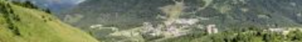
The small, beautiful and historic town of Briançon has been chosen as the starting point. It is the centre of the Serre Chevalier, a region that begins at the Col de l'Izoard in the south and ends at the Col du Galibier in the north – hence the name of the tour. The tour takes you over six Alpine passes and includes two suggested ‘sights’, although there are a number of other interesting stops along the way.
The Alpine passes are, in the order of the tour, the Col du Lautaret, the Col du Galbier, the Col du Télégraphe, the Col de l'Iseran, the Col du Mont Cenis and, finally, the Col de l'Echelle.
Briançon is an attractive starting point/destination for several tours in this part of the Western Alps. Tours are possible to the south as far as the first gorges, such as the Gorges da Guil, as well as to the south-east, including Alpine passes such as the Col de la Bonette, the Col Agnel and the Col de la Lombard. Even moderate off-road tours can be incorporated into day trips from Briançon. The Colle delle Finestre, for example, can be easily combined with the ‘Asietta Grenzkammstraße’ (Asietta border ridge road).
And there are other tours to the north. Like this one, the ‘Serre Chevalier’ tour – a brief description:
From Briançon, it is about 45 kilometres of leisurely climbing through the Guisane valley – on a wide, well-paved road – to the first 2,000-metre peak, the Col du Lautaret. Here, relaxed cruising is the order of the day. The top of the Col du Lautaret pass is relatively unnoticeable, as from here, unusually, another road branches off and is visible from afar, leading steadily uphill to the Col du Galibier.
Those who choose the route to the Col du Galibier rarely see the Col du Lautaret as a real Alpine pass. Unfairly so! Because if you don't turn off and follow the road, the pass descends again towards Le-Bourg-d'Oisans, which is then only 720 metres above sea level. This means a descent of around 1,500 metres.
However, our tour continues to the Col du Galibier, the fifth highest pass in the Alps. From the junction with the Col du Lautaret, the route becomes more challenging. The road is now narrower and in some places there are no barriers at the edge. You also need to watch out for larger oncoming vehicles. As there is a tunnel through the Col du Galibier about one kilometre below the pass, it is an attractive route for many motorhomes.
The route over the pass is closed to vehicles weighing 3.5 tonnes or more. And rightly so. It is winding and narrow. You should allow plenty of time at the top of the pass. Don't forget to take photos in front of the stone road signs. You should also take time to admire the view through the ‘metal eagle’ of the imposing mountain formations, the coat of arms of the ‘Serre Chevalier’. Basically, the upper section of the route offers magnificent views on both sides.
On the descent to Valloire, an attractive historic mountain village, there is a former alpine hut. It is worth stopping to try the cheese.
The ramp on this side is less spectacular than the one on the south side. Here you can make good progress.
Valloire is followed by the Col du Télégraphe, best known from the Tour de France. This Alpine pass is just under 1600 metres high. Valloire is already above 1400 metres. A long, straight ramp leads to the top of the pass – ideal for enjoying the spectacular view of the valley.
In Valloire, as on the Col du Télégraphe, there are restaurants and cafés – perhaps a good time to take a break before tackling the longer section on the country road to the Col de l'Iseran.
The descent from the Col du Télégraphe Alpine pass is nothing like the ascent. Around 20 bends, including several hairpin bends, take you to Saint-Michel-de Maurienne. Here, turn off towards the Col de l'Iseran.
On the way there, after the village of Villarodin, Fort Victor Emmanuel lies on the other side of the valley. It is a spectacular sight, an imposing fortress built during the reign of Empress Maria Theresa. On this side of the valley is a first ‘outer’ fortress, from which the actual fortress could be reached via a bridge. The fort is well worth a visit, but would have to be approached from the opposite side of the valley – a long detour that is not feasible given the length of this tour.
After about 60 kilometres of country road from Saint-Michel-de-Maurienne, you reach the charming village of Bonneval-sur-Arc, voted the most beautiful village in France a few years ago. From here begins the ascent to the highest paved pass in the Alps, the Col de l'Iseran.
A well-paved, wide, winding but easily navigable road leads up to the King of the Alps. The pass offers magnificent views, a restaurant and an old church, Notre-Dame de Toute Prudence. Halfway point. From here, the route takes you back a little, past Bonneval-sur-Arc – which, incidentally, is a good place for a late lunch break.
After Bonneval-sur-Arc, near Lanslebourg, you leave the route and turn off towards Col du Mont Cenis, a ski resort on this side of the Alpine pass. It is therefore not surprising that a wide, well-maintained road leads up to the high plateau of Col du Mont Cenis via just five hairpin bends. The pass is quickly reached, but from here a road several kilometres long leads along the lake, past the dam towards the eastern ramp. Although the Lac du Mont Cenis is artificially dammed, it is nevertheless very picturesquely nestled in the high valley. A series of forts and bunkers on both sides of the lake indicate that we are close to the Italian border.
A stop along the lake is a must. There are several restaurants and cafés here, all with views of the lake.
The descent from the Col du Mont Cenis Alpine pass begins spectacularly. A few hairpin bends take you down a steep slope before you reach another high valley, where the border station to Italy is located – although it is usually unmanned.
The rest of the route down to Susa also offers many beautiful and varied curves. As Susa is about 500 metres above sea level, this ramp is significantly longer. And important to note: on the Italian side, the road is in much worse condition.
From Susa, the route continues westwards via Bardonecchia to the last Alpine pass of the motorcycle tour, the Col de l'Echelle.
On the way there is the Forte di Exilles – an old fortress that has gained sad notoriety. It is said that the ‘Man in the Iron Mask’ was held here for his entire life. It is worth a visit if you have time and the fortress is open.
The Col de l'Echelle offers some beautiful combinations of bends and several short, unlit tunnels to round off the motorcycle tour, before the route returns to Briançon on a relatively straight road.
The PDF for the tour can be viewed here ...
And here is the link to the tour in the Alpine Passes Atlas to download GPS data.
Matching: Alpine passes